
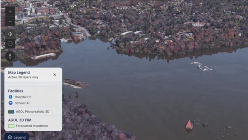
NOAA unveils new flood mapping tech to help communities better see risks before storms
The National Oceanic and Atmospheric Administration has introduced advanced flood mapping technology designed to enhance community risk assessment prior to severe weather events.
The story
in brief.
What happened, who it affects, and why it landed on our intelligence desk — in plain English, sixty seconds or less.
The National Oceanic and Atmospheric Administration has introduced advanced flood mapping technology designed to enhance community risk assessment prior to severe weather events. This initiative aims to provide clearer, more accurate visualisations of potential flood zones, enabling local authorities and residents to make informed decisions about safety and infrastructure. The technology represents a significant step forward in predictive environmental modelling, offering greater precision in identifying vulnerable areas. By improving the clarity of risk data, NOAA seeks to reduce uncertainty and support proactive disaster preparedness strategies across affected regions, ultimately fostering greater resilience against increasingly frequent extreme weather conditions.
Indicative index of skill mentions in professional job postings for the field this story moves (2019 = 1)
What this means
for your career.
Every headline redistributes opportunity. Here is who this one rewards — and how to be on the right side of it.
This development signals a growing demand for professionals who can interpret complex environmental data and translate it into actionable risk mitigation strategies. You should focus on enhancing your skills in data analysis and spatial modelling to remain competitive. Professionals in urban planning, engineering, and public administration must now integrate these advanced mapping tools into their workflows. Consider upskilling in Geographic Information Systems and climate risk assessment. A smart professional will proactively seek certifications in data visualisation and emergency management planning. By mastering these competencies, you position yourself as a critical asset in organisations preparing for climate-related disruptions. Embrace this shift towards data-driven decision-making to secure your career relevance in an evolving landscape.
For this story, the fields that convert it into pay are Data Science, Risk Management Strategies, Engineering and Crisis Management — exactly the programmes matched below. The chart shows the indicative salary uplift certified professionals report in each of those fields; every one of them is a click away, from £79, finishing in as few as 20 days.
Indicative ranges from published continuing-education salary studies, by field — each field is a recommended course below
Enrol in these
to benefit.
These programmes position you for exactly this shift — online, self-paced, and finishing with a verifiable certificate you can share the day you pass.
 Best match
Certificate in Data Science
 Recommended
Certificate in Risk Management Strategies
Recommended
Certificate in Engineering
 Recommended
Certificate in Crisis Management
Launch pricing shown against standard certificate value. The fee you see today is the fee you lock in.
This briefing is based on reporting by KOMO on 28 Sep, 21:52. Read the original coverage →
Read the news. Then outrun it.
Every OnlineUni programme is online, self-paced and from £79 — so a headline today can be your credential this month.